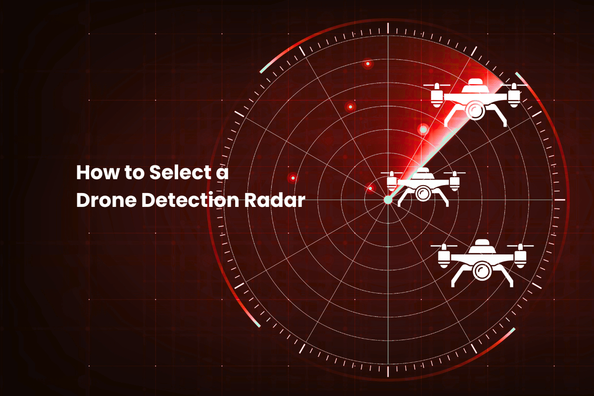
How to Select a Drone Detection Radar
 The Skylock Team
Abstract
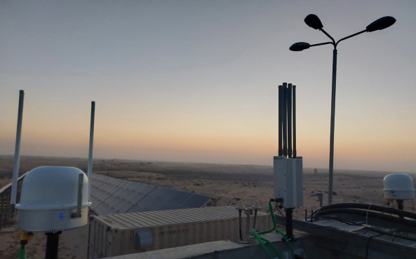
A drone detection radar is a specialised sensor system engineered to continuously scan airspace for low, slow, and small unmanned aerial systems. Unlike conventional aviation radars designed for large, stable targets, these systems utilise advanced signal processing algorithms to detect and track objects with an extremely small Radar Cross Section (RCS). The technology functions by emitting radio frequency waves and analysing the return signals to establish persistent track continuity, operating reliably in environmental conditions that degrade optical sensors, such as total darkness or thick fog.
Choosing a drone detection radar often fails when it is treated as a mere spec sheet contest rather than an operational necessity. While a brochure might boast impressive detection distances, those figures frequently collapse when faced with the reality of a low RCS target manoeuvring through heavy ground clutter.
Unlike a plane, which has a relatively stable signature, a drone’s RCS changes constantly as it tilts to manoeuvre or as its propellers spin. Small drones often have an RCS as low as 0.01 m², which can push detection and tracking into the noise floor in cluttered environments.
This guide provides a practical selection method tailored to your specific site geometry and integration requirements. We move beyond theoretical ranges to focus on a robust checklist covering terrain constraints, clutter tolerance, and workflow orchestration. You will learn how to transition from fragmented data to a unified defence posture.
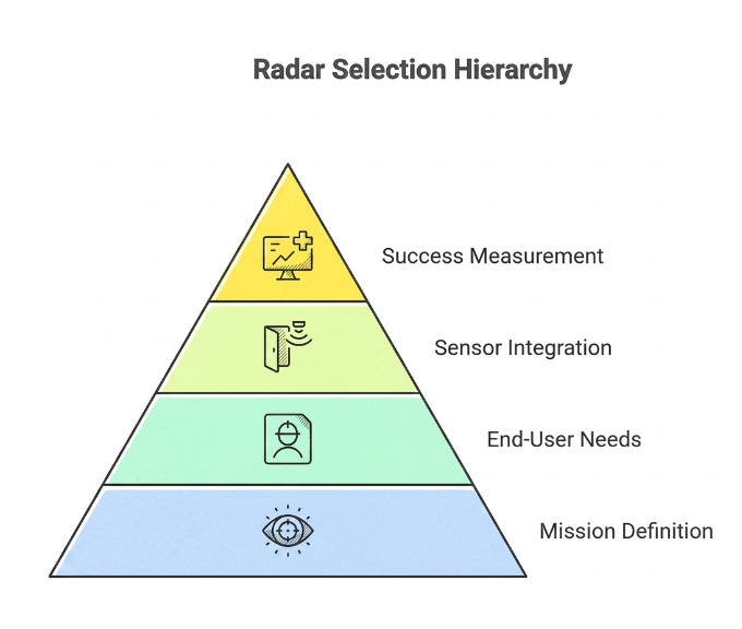
Start with the mission, not the radar.
Selecting a detection system begins with defining the specific operational outcome required for your environment. Whether the priority is long-range early warning for critical infrastructure or maintaining strict track continuity in a complex urban setting, the mission dictates the technical specifications. You must determine if the goal is simply to alert a security team or to feed real-time data into an automated base defence C2.
Clarifying the end-user is equally vital. High-fidelity separation is the priority for Air Traffic Control, whereas maritime operators spend most of their time fighting sea clutter. Radar shouldn’t be viewed as a total solution. Instead, think of it as the lead sensor in a larger stack. Its job is to establish a track so the rest of your security tools can take over. Effective selection requires a principle-first approach: the radar must seamlessly trigger the subsequent verification and response workflow. Success is measured not by the detection alone, but by how effectively it enables a safe, verified, and timely intervention by the designated operators.
What drone detection radar does well (and where it struggles)
While passive sensors have a role, radar is often the primary sensor for long-range detection and track generation. It delivers persistent updates and track continuity that help maintain an accurate operating picture across wide areas.
It doesn’t rely on perfect conditions either. While cameras and optical tools start to fail the moment the sun sets or the weather turns, radar stays reliable in total darkness or thick fog. It gives you a level of persistence that other sensors just can’t match when visibility hits zero. It is designed to find and follow “low, slow, and small” (LSS) threats that would otherwise go unnoticed until it’s too late.
However, the real challenge lies in the physics of the “Radar Cross Section” (RCS). A small drone made of carbon fiber or plastic barely reflects a signal, making it difficult to distinguish from the background noise of the physical environment. The environment is constantly working against the sensor. Buildings or even just trees blowing in the wind create “ground clutter” that easily swallows the signal of a small drone. If a threat stays low to the ground, even small changes in the terrain can hide it from view entirely. On the software side, the system has to work incredibly hard to tell the difference between a drone swarm and a flock of birds, which is why you see so many false alarms.
On the software side, the system has to work incredibly hard to tell the difference between a drone swarm and a flock of birds, which is why you see so many false alarms. Radar excels at detection and track generation; identification typically requires EO/IR (and/or RF) for positive visual confirmation and evidentiary capture. The radar finds the target, but the EO/IR system provides the “pixels on target” needed to classify the threat and justify a proportional response. The radar finds the target, but the EO/IR system provides the “pixels on target” needed to classify the threat and justify a proportional response.
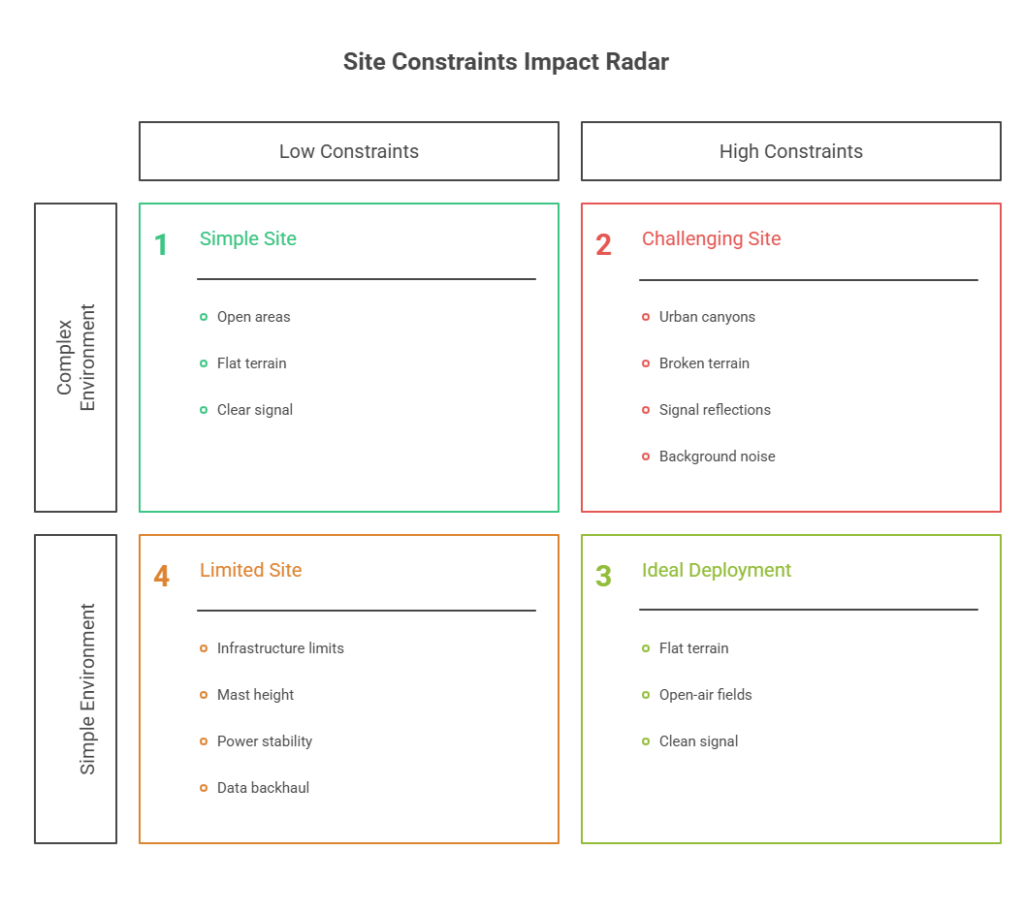
Define your site and environment constraints.
A radar’s performance depends entirely on its environment. You have to look at the actual layout of the deployment zone because things like the local topography and existing infrastructure will dictate your data context and quality.
- Terrain and geometry: The choice between a high-power, long-range unit and a distributed network of smaller sensors depends on whether you are monitoring flat open areas, open-air fields, broken terrain, urban canyons, or complex shorelines.
- Clutter sources: Potential interference from migratory bird paths, moving vehicles, construction cranes, and masts must be mapped to minimise false tracks and signal reflections.
- Coverage shape: Selection is driven by the required protective envelope, whether that involves a 360-degree perimeter ring, specific approach paths, or high security layered zones.
- Emissions and signature concerns: In tactical or high-threat environments, low probability of intercept (LPI) characteristics are vital to ensure the system does not become a beacon for adversary intelligence.
- Infrastructure realities: Deployment is often limited by practical factors such as mast height availability, power stability, data backhaul capacity, and the need for system hardening or mobility.
Choose the right radar category (by deployment model)
The marketplace for detection technology is segmented into distinct categories designed to address specific environmental challenges. Selecting a sensor based on its deployment model ensures the underlying signal processing and hardware architecture are fit for purpose and reduces exposure of critical infrastructures.
Fixed-site wide-area ground surveillance
These systems provide persistent 24/7 cueing for large perimeters such as airbases and critical infrastructure, prioritising long-range reliability and permanent integration. They are typically designed for continuous operation over years, featuring a high mean time between failures and the ability to integrate with existing site security management systems. These radars serve as the primary sensor for detecting threats at the maximum possible distance, enabling extended reaction times.
Compact tactical/expeditionary
These units are for when you’re moving fast. If you’re with a convoy or at a temporary site, you can’t wait around for a complex install. They are lightweight and low-SWaP, and can be rapidly emplaced by a single operator on a tripod or vehicle mast.
You get your eyes on the area immediately, and that’s the whole point. While they may offer less range than fixed installations, their portability makes them essential for protecting forward operating bases or VIP events.
3D air surveillance / multi-mission
These radars offer high-fidelity elevation data and integrate seamlessly into a broader integrated air defence picture, tracking both traditional aircraft and small drones. By providing precise altitude information, they allow operators to distinguish between ground-level interference and genuine airborne threats more effectively than 2D counterparts. These systems are often chosen when the mission requires coordination with military or civil aviation authorities.
Urban/clutter-optimised
Urban surveillance is all about managing nuisance alarms. These sensors focus on filtering out the clutter from buildings and traffic so you get a clean picture. They are built to handle the signal interference and multipath effects that come with city centres, ensuring the system stays reliable even in the middle of a high-interference zone. This specialisation ensures that security teams are not overwhelmed by false positives while maintaining a high probability of detecting small drones.
Maritime-capable
Engineered for ports, coastal areas, and offshore platforms, these systems include specialised waveforms to suppress sea clutter and operate in high salt corrosive atmospheres. The signal processing is tuned to ignore wave motion while locking onto the distinct flight signatures of a UAS. Furthermore, the hardware is often ruggedised with marine-grade coatings to prevent degradation from constant exposure to sea spray.
A simple rule applies regardless of technical specifications: you must choose the category that matches your specific environment before you begin comparing individual models. Aligning the deployment category with your mission profile is the only way to ensure the radar performs effectively once installed.
Key performance questions that matter more than maximum range
Maximum range is just a headline figure. It doesn’t tell you how the radar will actually perform when things get complicated. If a system can see for miles in the desert but goes blind at five hundred metres in an urban setting, it’s a failure. In the field, being able to cut through the clutter is much more important than the theoretical distance. Real-world effectiveness depends on the system’s ability to maintain a stable track under pressure and to provide actionable data to the rest of the security stack.
Performance is highly site-dependent; a system must be evaluated against the specific geometry and interference in your deployment zone. Use the following checklist to move beyond basic specifications and assess how a radar will truly behave in the field.
| Operational Priority | Critical Evaluation Questions |
| Clutter Management | How does the signal processing handle specific environmental noise, such as moving vegetation, urban multipath reflections, or sea clutter? |
| Track Stability | Can the system maintain a consistent track on targets flying at very low altitudes or hovering at low speeds without dropping the signal? |
| Sensor Integration | Does the radar provide the low latency, high update rate, and positional accuracy required to cue a camera for visual verification automatically? |
| Saturation Handling | How does the system behave when faced with multi-target saturation, and does track quality degrade as the target count increases? |
| False Alarm Control | What specific tools are available for nuisance alarm management, such as customisable software filters, classification aids, or manual operator controls? |
| Site Variables | How significantly do installation variables like mast height, physical obstructions, and local siting geometry alter the stated performance results? |
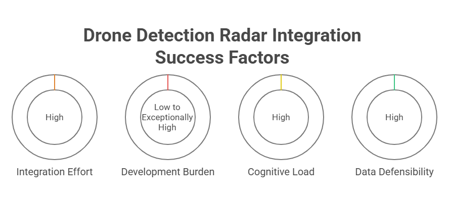
Integration and workflow requirements (this is where most programs win or lose)
The technical efficacy of a radar system is tied to its ability to enable rapid response through deep subsystem orchestration. The goal is a seamless link between your radar and your cameras. You need that slew-to-cue to be fast enough to catch high-speed targets at a distance without any delay. It’s also about more than just the visual; the whole setup needs to automatically record the telemetry and video while keeping your communication with the response team secure.
The integration effort required often represents the primary hidden complexity of a project. Depending on whether the radar utilises open standards such as ASTERIX or proprietary protocols, the development burden can range from low to exceptionally high. System designers must evaluate API maturity and C2 middleware flexibility to ensure the ingestion of disparate track formats. Failure to address these interface requirements leads to fragmented architectures that require costly custom software bridges to achieve basic interoperability.
Ultimately, the goal is to prevent a scenario in which operators monitor siloed sensor screens, which increases cognitive load and slows decision-making. A good workflow brings everything into one screen, using automation to sort through threats and assign the right sensors to the job. When you combine radar and cameras into one unified system, you ensure the move from finding a target to identifying it is consistent. It also makes your data much easier to defend legally because the process is recorded and repeatable.
Verification strategy: how radar should cue EO/IR
Radar gives you the “where,” but cameras give you the “what.” You need that visual confirmation of drone detection to be sure of what you’re seeing, especially when a bird and a drone look almost identical on a radar screen. EO/IR verification is a primary method for resolving ambiguous tracks and reducing nuisance responses, alongside radar tuning, environmental filtering, and multi-sensor correlation. Before you ever deploy a countermeasure, you have to verify the threat visually to make sure your response is actually justified.
Superior cueing is defined by the precision and speed of the kinematic handoff between the radar track data and the camera pan, tilt, and zoom controller. A sophisticated integration utilises low-latency coordinate transformation to ensure the optical sensor slues to the exact spatial coordinates provided by the radar, even when tracking high-velocity targets at extreme ranges.
- Precision handoff: High frequency update rates are required to ensure the camera boresight remains aligned with the target’s predicted flight path.
- Operator light workflow: SKYLOCK supports seamless radar-to-camera cueing and automated evidence bundling, reducing the manual burden on security personnel.
- Decision support: Integrated evidence packages combine radar telemetry with visual footage, providing a defensible audit trail for incident response.
Response considerations (legal, ROE, and safety constraints)
You have a few ways to respond, whether that’s just watching the target or moving to stop it, but the law and your ROE always set the boundaries. You have to stay within those legal frameworks. It’s also worth noting that you can’t start mitigating threats unless you have the proper authorisation from the regulators who handle the airspace and radio frequencies. In many jurisdictions, the authority to jam or physically intercept a drone is restricted to specific state actors or high-security environments.
The procurement reality is that a system must be designed to deliver value even when mitigation is legally or safely constrained. Detection and verification layers provide critical situational awareness, enabling the deployment of ground security or notifying law enforcement. By ensuring the detection and evidence gathering phases are robust, the system provides a defensible audit trail and actionable intelligence, regardless of whether a kinetic or electronic response is permitted on site.
Selection guide by use case
You need to pick a radar that actually fits the space you’re working in. It’s about aligning what the sensor is good at with the limitations of the site itself. Based on the categories we just covered, you can narrow down which system architecture is going to handle your specific environment the best.
| Use Case | Recommended Radar Architecture | Operational Priority | Key Integration Requirements |
| Airports | 3D Air Surveillance / Multi-Mission | High-confidence identification and maintaining a clear air picture alongside traditional aviation. | Coordination with Air Traffic Control; generating incident evidence; minimal nuisance alarms from ground equipment. |
| Military Bases | Fixed-Site Wide-Area Ground Surveillance | Persistent cueing for perimeter security and handling complex, multi-target threats. | Deep integration with base defence C2 systems; rapid escalation and coordinated response workflows. |
| Critical Infrastructure | Urban / Clutter-Optimised | High tolerance for industrial clutter and interference from metal or glass structures. | Low operator burden; foolproof audit trails for regulatory compliance and insurance purposes. |
| Borders | Distributed Tactical / Expeditionary Nodes | Minimising coverage gaps across vast, unmonitored distances and overcoming terrain masking. | High mobility to shift with threat patterns; robust performance over difficult terrain and communication hurdles. |
| Ports & Maritime | Maritime-Capable Systems | Suppression of sea clutter and managing a mixed picture of surface vessels and aerial drones. | Seamless integration with Maritime Operations Centres; durability in corrosive, high-salt environments. |
Stop Buying Specifications, Start Securing Airspace
Good drone defence isn’t something you can just buy off a shelf; it’s the result of following a solid plan. You have to start by defining exactly what you’re trying to achieve and doing a proper audit of the site’s physical hurdles. Once you have that figured out, you can pick the right radar category to fit into your wider system and workflow. This is how you make sure that every time a target is found, it leads straight to a verified ID and a response you can actually defend in court.
When evaluating competing systems, you must prioritise verification speed and reduced operator workload over theoretical brochure range. A radar that detects a threat at extreme distance is of little value if the subsequent verification cycle is too slow to permit a safe intervention. Your investment should focus on the seamless orchestration of sensors to provide a high-confidence, actionable operating picture.Talk to SKYLOCK about integrating radar cueing with verification and ROE-aligned response workflows. Request a site-specific drone threat and coverage assessment.