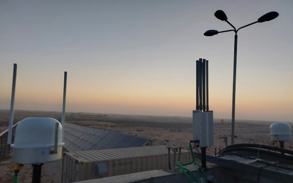
10 Drone Detection Systems Solutions by Category and Use Case
 The Skylock Team
In high-clutter environments, a visual-only defense is essentially a high-definition spectator. Whether it’s a “dark drone” hugging the treeline or a swarm lost in urban RF noise, modern threats are designed to exploit the gaps in single-dimension sensing.
This is why achieving awareness is the fundamental requirement for ensuring mission continuity and protecting critical infrastructure. You must be able to detect, identify, and respond to threats in real time before they reach your perimeter. The FAA now receives more than 100 reports of drone sightings near airports every month, and DHS is also finalizing a $115 million investment in counter-drone technology to help secure America250 activities and the 2026 FIFA World Cup.
This guide breaks down the multi-layer architecture required to move from reactive monitoring to true operational assurance.
What is a Drone Detection System Solution?
A drone detection system is a specialized technology stack designed to identify, track, and characterize unmanned aerial vehicles (UAVs) entering a protected airspace. Unlike traditional surveillance, which may rely on generalized motion sensors or manual observation, these systems utilize a sophisticated blend of Radio Frequency (RF) sensors, radar, and electro-optical/infrared (EO/IR) imaging to maintain a constant “eye on the sky”.
Functionally, a modern drone detection solution supports a structured detect–verify–respond workflow, effectively serving as the front end of a counter-UAS engagement/decision chain. In operational terms, it means correlating sensor cues into a track, confirming the object of interest, presenting decision-ready information to the operator, and enabling a response that aligns with local authorities, regulations, and rules of engagement. That ability to sustain reliable visibility and verified identification is what enables operational assurance in real environments.
The Three Pillars of Detection
To achieve true operational assurance, a system must be built upon three functional pillars:
- Continuous Monitoring: 24/7 coverage across relevant RF bands with sensor cueing for visual confirmation.
- Target Classification: Prioritize likely drone tracks and reduce false alarms; “dark drones” require corroborated tracking, not assumed intent.
- Unified Processing: Correlate radar/RF/EO-IR into one track picture (confidence + provenance) for faster, decision-ready response.
How We Rated the Top Drone Detection Solutions
Each solution was assessed against the following five critical metrics:
- Detection Performance: Detect/track small UAS at acceptable Pd and false alarms (detect/track/identify differ).
- False Alarm Rate (FAR): How well it separates real threats from clutter (e.g., birds/vehicles) to prevent alarm fatigue.
- API Interoperability: How cleanly it integrates with existing C2/C4I and third-party security platforms.
- Deployment Flexibility: How well it supports fixed sites, on-the-move protection, and rapid tactical setups.
- Operational Validation: Evidence of real-world use plus completion of relevant acceptance/compliance testing (e.g., gov standards, CUI basics, SATs, program qualification).
Top Drone Detection Solutions
| Solution | Best For |
| Echodyne (EchoGuard) | Early warning + precision tracking in cluttered airspace (radar-led) |
| Meteksan (Retinar) | Wide-area perimeter and border surveillance in rugged terrain (radar-led) |
| SKYLOCK Multi-Layer System | End-to-end detect–verify–respond with open-architecture C2/C4I integration (operational assurance) |
| Dedrone | Rapid detection and pilot localization in dense urban RF environments (RF-led) |
| Rohde & Schwarz (ARDRONIS) | High-fidelity signal classification and direction finding for early warning (RF monitoring/ES) |
| Sentrycs | Protocol-based detection (and controlled outcomes where supported) in dense cities |
| Teledyne FLIR | Day/night visual verification and target confirmation after cueing (EO/IR-led) |
| DroneShield | Rapidly deployable, tactical and portable multi-sensor protection (field-forward) |
Top 10 Drone Detection Systems Solutions by Category and Use Case
Radar-Based Drone Detection Systems
Radar-based detection is a foundational technology in airspace security that utilizes radio waves to detect and track airborne objects at significant distances.
What Features Should You Look For?
- Long-Range Detection: The ability to identify small RCS (Radar Cross Section) targets several kilometers away to provide maximum reaction time.
- Environmental Filtering: Advanced algorithms that can distinguish between a drone and “clutter,” such as birds, swaying trees, or weather patterns, to minimize false positives.
- Real-time Tracking: The capacity to maintain continuous tracking on multiple targets simultaneously, providing smooth and accurate telemetry data.
What Benefits Does This Category Provide?
- Early Warning Capability: Radar often provides the widest-area discovery and tracking of non-cooperative targets.
- Works in Low Visibility: Radar typically provides more consistent coverage than EO-only sensors in low-visibility conditions.
1. Echodyne (EchoGuard Radar)
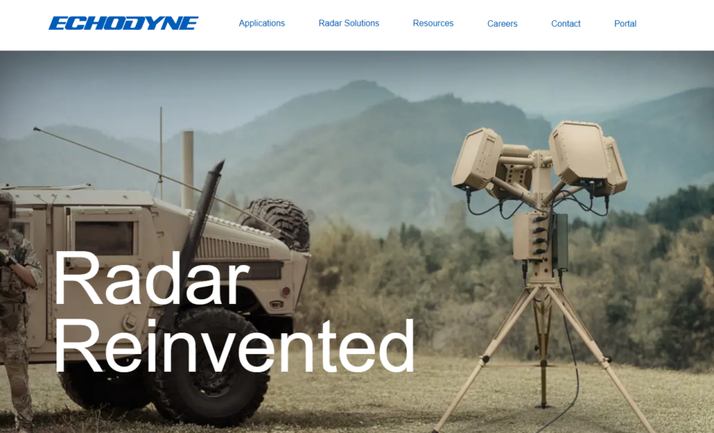
Echodyne offers the EchoGuard Radar, a high-performance MESA (Metamaterial Electronically Scanned Array) system. It is specifically designed to provide ultra-low size, weight, and power (SWaP) while delivering the 3D precision tracking usually reserved for much larger, more expensive military-grade radars.
2. Meteksan Defence (Retinar Radar Systems)
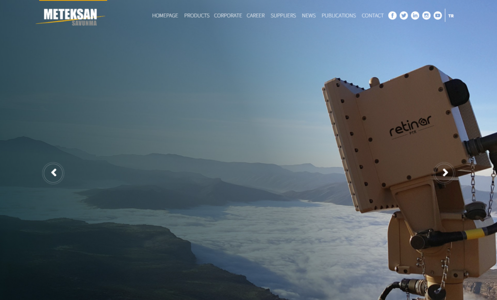
Meteksan Defence specializes in the Retinar Radar family, engineered for detecting small, slow-moving targets in complex environments. Their systems are designed for durability and are used in rugged military applications to secure high-value assets.
Use Case
- Border Security: Monitoring long stretches of national borders to detect illegal crossings or smuggling attempts via drone.
- Perimeter Defense: Protecting the outer boundaries of expansive sites, such as military bases, correctional facilities, or industrial complexes.
Multi-Layer Drone Detection and Defense Systems
Single-sensor detection leaves gaps in real-world clutter. Multi-layer systems fuse radar, RF, and EO/IR into one architecture, reducing single points of failure and delivering a more reliable operational picture than any standalone sensor.
What Features Should You Look For?
When evaluating a comprehensive multi-layer solution, prioritize systems that offer:
- Sensor Fusion: The ability to automatically correlate data from radar, RF, and thermal cameras into a single identified track.
- Modular Architecture: A “plug-and-play” design that allows for the addition of new sensors or mitigation effectors as threats evolve.
- Automated Response Triggers: Configurable protocols that reduce Human-in-the-Loop workload by automating alerting, cueing (e.g., slew-to-cue), logging, and escalation steps while any mitigation or engagement remains governed by policy, authority, and ROE.
What Benefits Does This Category Provide?
Multi-layer systems combine radar, RF, and EO/IR to reduce gaps and speed verification. Performance still depends on weather, clutter, spectrum congestion, line of sight, and target behaviour.
3. SKYLOCK Multi-Layer Drone Detection and Defense System

SKYLOCK is an integrated counter-UAS platform built on an open-integration philosophy. Rather than functioning as a closed loop, the SKYLOCK platform can act as a centralized command-and-control (C2) layer that unifies multiple sensing technologies.
Positioned as a field-proven solution for national security, SKYLOCK’s architecture enables seamless integration with existing security infrastructure. It is designed to move beyond simple detection, supporting a detect–verify–respond workflow that can include sensor-driven cueing, verification, and response options aligned with local legal authority and ROE, managed through a single operator interface.
Use Cases
- National and Homeland Security: Protecting government buildings, high-profile public events, and national borders from aerial incursions.
- Military and Defense Operations: Providing force protection for forward operating bases and mobile convoys against surveillance or “kamikaze” drone swarms.
- Critical Infrastructure Protection: Securing power plants, oil refineries, and data centers and private-sector sites where a single drone breach could cause catastrophic disruption.
- Airports and Airspace Security: Managing the complex integration of authorized drone activity while detecting and neutralizing unauthorized threats that risk passenger safety.
RF-Based Drone Detection Systems
Radio Frequency (RF) based detection is a passive surveillance technology that can identify drones by monitoring RF emissions and (when active) communication links between the unmanned aerial vehicle (UAV) and its ground control station (GCS). By scanning the electromagnetic spectrum, these systems “listen” for the unique digital signatures emitted during data transmission, command and control, and video downlinks.
What Features Should You Look For?
- Broad coverage: Scan key drone bands (e.g., 2.4/5.8 GHz) plus other common links.
- Classification: Use protocol libraries to separate drones from Wi-Fi/clutter.
- Localization (when possible): DF/triangulate the controller when it’s transmitting; accuracy depends on the environment and link behavior.
What Benefits Does This Category Provide?
- Attribution (when possible): RF can sometimes estimate the controller/launch area via DF/triangulation when the link is active.
- Urban utility (with limits): Can detect link activity beyond camera LOS, but performance depends on congestion, multipath, antenna placement, and whether the drone is transmitting.
4. Dedrone

Dedrone is a well-established provider of RF-based drone detection, offering a sensor-fusion platform that identifies, classifies, and mitigates drone threats in real time. Their software-led approach allows for rapid database updates as new drone models enter the market.
5. Rohde & Schwarz (ARDRONIS)

The Rohde & Schwarz ARDRONIS system is engineered for high-precision radio monitoring and direction finding. It is designed for high-precision radio monitoring and direction finding in congested RF environments, supporting early warning for critical infrastructure.
6. Sentrycs

Sentrycs provides a protocol-based approach that can support both detection and controlled outcomes on certain drone families where protocols are supported and conditions allow. Any mitigation effect depends on the specific target, firmware/protocol compatibility, link conditions, and local legal authority and operational rules. Careful spectrum management is still required to minimize unintended effects on nearby communications.
Use Case
Urban Security: Protecting stadiums, government buildings, and public squares from unauthorized overflights in densely populated areas.
Law Enforcement: Providing police units with the tools to find and apprehend illegal drone operators during public events or near restricted correctional facilities.
EO/IR and Visual Detection Systems
EO/IR uses optical and thermal cameras for visual verification after radar/RF cues. Thermal helps at night; optical zoom helps recognition. Performance depends on range, weather, clutter, and line of sight.
What Features Should You Look For?
- Thermal + optical: Dual sensors support day/night viewing; zoom aids recognition.
- AI-assisted recognition: Analytics can reduce workload, but accuracy varies by optics, weather, clutter, and training.
- Automated tracking: Slew-to-cue tracking helps maintain visual lock once cued.
What Benefits Does This Category Provide?
- Visual verification: Provides “eyes-on” confirmation before authorizing response.
- Fewer false alarms: Confirms sensor alerts so teams only act on genuine threats.
7. Teledyne FLIR

Teledyne FLIR is a major provider of thermal imaging technology. Their counter-UAS offerings integrate long-range EO/IR sensors with sophisticated analytics, providing the high-fidelity imagery necessary for mission-critical decisions.
8. Walaris
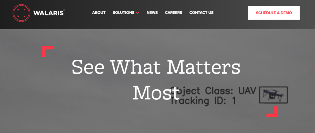
Walaris specializes in AI-driven optical software that transforms standard camera feeds into autonomous drone tracking and identification stations, focusing on high precision and ease of integration.
Use Case
- Airports: Monitoring runways and flight paths to ensure visual confirmation of any drone activity that could disrupt manned aviation.
- High-Security Facilities: Protecting sensitive sites such as data centers and government buildings, where identifying the drone’s payload is a top priority.
Specialized Detection Systems (Acoustic, LiDAR, Hybrid)
Specialized detection refers to alternative or niche sensing technologies, such as acoustic arrays that “listen” for motor frequencies or LiDAR (Light Detection and Ranging) systems that use laser pulses for ultra-precise 3D mapping. These are niche layers to fill gaps where RF or radar are limited.
What Features Should You Look For?
- Passive detection: Acoustic sensors are non-emitting, giving a low EM signature.
- LiDAR (niche): High-resolution LOS measurement; range and weather limited.
- Integration: Use as a complementary layer feeding a central C2/C4I view.
What Benefits Do Specialized Detection Systems (Acoustic, LiDAR, Hybrid)Provide?
- Low-signature cueing: Passive sensors don’t emit RF, supporting low EM profiles in tactical use.
- Close-in support: Acoustic cues can help where LOS sensors are masked, but performance is weather/noise dependent—best as a short-range complement.
9. DroneShield

DroneShield offers a diverse range of specialized multi-sensor platforms, including portable and fixed-site acoustic and RF detection systems designed for rapid deployment.
10. OSL Technology

OSL Technology specializes in integrated “Horizon” systems that often utilize hybrid sensor arrays to provide high-resolution tracking and situational awareness.
Use Case
- Tactical Environments: Passive, close-in cueing where emissions matter.
- Urban and Event Security: Monitoring public gatherings or stadium events where high levels of electronic “noise” make traditional detection difficult.
Why You Need Open-Architecture C4I Integration
A drone detection system is only as effective as the software that manages it. C4I (Command, Control, Communications, Computers, and Intelligence) integration acts as the centralized command layer that unifies data from diverse multi-sensor systems into a single interface. By aggregating feeds from radar, RF, and EO/IR sensors, C4I enables real-time operational awareness, allowing security teams to see a single, fused track of a target rather than multiple conflicting signals.
Why it matters
- Avoids lock-in: Mix and match sensors by layer rather than a single vendor stack.
- Enables integration: Add new sensors/effectors via standard interfaces.
- Future-ready: Upgrade modules over time without a full rip-and-replace, with planned upgrades for rapid shifts in AI computing, automation, and cyber risk.
Selecting the Right Drone Detection Systems Solution Configuration for Operational Assurance
To achieve true operational assurance, the hardware configuration must match the specific environment and mission profile. Most solutions are categorized into three primary deployment types.
Fixed-Site Systems
These are permanent installations designed for persistent infrastructure protection. They are ideal for high-value targets such as power plants, government buildings, or large airports, where constant, long-range surveillance is required 24/7.
On-the-Move Systems
Designed for convoys and mobile defense, these systems are mounted on vehicles to provide a protective “bubble” while in transit. They use specialized sensors that maintain accurate tracking while the platform is moving.
Tactical Deployments
Focused on rapid response and field operations, tactical systems are often man-portable or “luggage-sized” for quick setup. These are used by special forces or emergency response teams who need to establish immediate airspace security in remote or temporary locations.
From Airspace Visibility to Operational Certainty
The security landscape has shifted; the conversation is no longer merely about “detecting drones”. In a modern, high-threat environment, the true objective is to manage complex airspace risk in real time.
The industry is moving toward a standard in which detection, verification, and response are no longer isolated events but are part of a unified detect–verify–respond workflow. SKYLOCK exemplifies this shift from point coverage to operational continuity. To maintain mission continuity amid evolving aerial threats, your defense strategy must be as multidimensional as the risks you face. Moving beyond standalone sensors toward an open-architecture, integrated C-UAS ecosystem is the only way to ensure future-proof protection. Evaluate Your Airspace Risks with a SKYLOCK Defense Expert today.