Drone detection and tracking: An essential guide
 The Skylock Team
Abstract
Drone detection and tracking is the operational process of identifying potential unauthorised drones, tracking their movements through protected airspace, and determining whether a security response is required. It lets operators go from one alert to a confirmed picture of the drone’s location, behaviour and threat relevance.
This guide explains:
- Why detection alone does not give operators enough context to act
- How track continuity helps teams maintain confidence during an incident
- Why real-world environments create false alarms, clutter, and coverage gaps
- How RF, radar, EO/IR, and AI-assisted classification contribute to a reliable drone track
- How detection and tracking support a repeatable workflow from alert to verified action
- What procurement teams and systems integrators should evaluate before selecting a drone detection and tracking system
A drone alert is not the same as operational control. For security teams, the challenge is knowing where the object is, whether it is still being tracked, whether it is actually a drone, and what action is authorised before the response window closes.
That challenge is growing as drones become part of the low-altitude threat environment. They can be used for surveillance, contraband delivery, disruption, or payload delivery across airports, critical infrastructure, borders, maritime sites, and government facilities. In one UAV radar field experiment, the system initially extracted 210,952 possible signal points. Most were not useful drone tracks. They were noise, clutter, or false-alarm points caused by the environment and radar processing. After false-alarm suppression, only 14,634 points remained, eliminating more than 93% of false peaks. The researchers also noted that these false alarms can disrupt tracking continuity and make the real UAV trajectory harder to follow.
Drone detection and tracking is the process of identifying potential drone activity, maintaining continuous tracking, verifying the object, and feeding decision-ready information into an authorised response workflow. Detection tells operators that something may be there.
What is drone detection and tracking?
Drone detection and tracking is the process of identifying, locating, and continuously monitoring unknown or unauthorised drones within protected airspace. For defence, airport, border, maritime, and critical infrastructure teams, it is not simply a technical function. It is the first stage of an operational decision workflow. For critical infrastructure operators, drone detection should sit within broader critical infrastructure security best practices, including layered protection, verified alarms, clear escalation paths, incident logging, and response actions aligned with legal authority and site-specific safety constraints.
Detection confirms the possible presence of a drone. This may come from RF activity, radar returns, optical cues, acoustic signatures, or another sensor source. At this stage, the system is saying that something in the airspace may require attention.
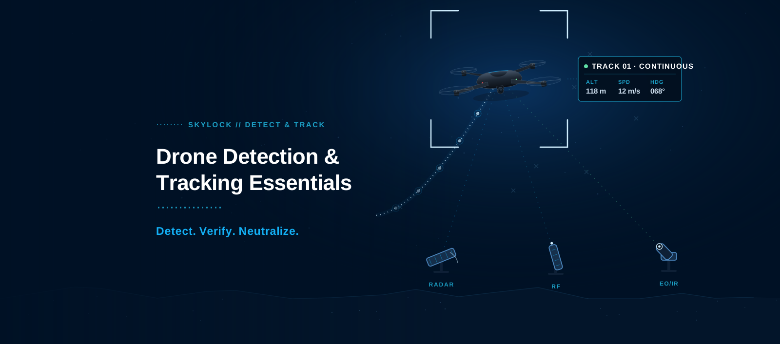
Tracking adds the operational context operators need. It maintains a live picture of where the drone is, how it is moving, altitude, speed, direction of travel, and proximity to protected areas. This gives teams the ability to determine if the object is loitering, transiting, retreating or closing on a sensitive asset.
Then comes the verification. It checks whether the object is a drone, whether it is unauthorised, and whether it meets the threshold for escalation or response.
This distinction matters because detection is only the first step. A single alert is not enough to give the operators enough confidence to make a reliable decision. Effective counter-UAS systems must maintain continuity, correlate sensor inputs, and present a stable airspace picture to support rapid, proportionate action.
Why detection alone is not enough
Operators still need to know whether the object is a drone, whether the track is stable, whether it’s moving toward a restricted zone, and whether the response threshold has been triggered. Without that context, an alert can bring uncertainty instead of clarity.
Continuity of the track is essential here. Repeated loss and reacquisition of the target cause a loss of time and confidence among operators. They may not know whether they are looking at the same drone, a second drone, or a false alarm caused by clutter, birds, RF noise, or other environmental factors.
That uncertainty feeds into every downstream decision. It is harder to verify, escalation can be delayed, and camera cueing is slower. Effective counter-UAS detection is not about generating more alerts. It’s about creating a stable, verified picture of airspace that operators can understand, trust and act upon.
Why drone detection fails in real environments
Small drones are difficult targets. They have a low visual signature, a small radar cross-section, and flight profiles that keep them close to terrain, buildings, or infrastructure. At low altitude, a drone may sit below the coverage pattern of traditional air surveillance systems or appear only intermittently as it moves behind obstacles.
The environment creates additional uncertainty. Buildings, terrain, trees, cranes, vehicles, birds, and moving vegetation all produce clutter that detection systems must separate from genuine drone activity. The same principle applies to government facility perimeter protection, where detection, verification, tracking, and response must work as one operational workflow rather than as separate sensor alerts.
RF-based detection faces its own limits. Congested spectrum can make signal interpretation harder, especially around facilities with dense communications, Wi-Fi, telemetry, and industrial systems. Autonomous or pre-programmed drones may emit little or no active control-link activity, reducing the value of systems that depend heavily on RF emissions.
Optical systems also depend on conditions. Visual confirmation can be delayed or degraded by darkness, fog, rain, glare, distance, and obstructed line of sight, but EO/IR cameras can support verification.
That’s why you should treat brochure performance with care. What works in open terrain may not work as well once deployed into a complex, cluttered, spectrum-heavy environment. Effective drone detection and tracking requires layered sensing, sensor correlation, and a unified operating picture, rather than relying on a single sensor type to address every condition.
The real performance metric is track continuity.
The real measure of a drone detection and tracking system is not whether it can produce a first alert. It is whether it can maintain track continuity long enough for operators to verify the object, assess its behaviour, and respond within the available decision window. For radar-led deployments, this is why selecting a drone detection radar should go beyond maximum-range claims. Procurement teams should assess whether the radar can maintain a stable track in the site’s actual terrain, clutter, installation geometry, and operating conditions.
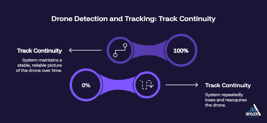
Track continuity is the system’s ability to maintain a stable, reliable picture of the drone over time. The system must keep tracking the target as it changes altitude, direction, speed, and proximity to protected zones. A drone that is detected once, then repeatedly lost and reacquired, does not give operators the same level of confidence as a continuous track.
When continuity is poor, the operational picture starts to break down. Operators may lose confidence in the alert. Camera cueing slows or becomes less accurate when the EO/IR system is pointed at an outdated or unstable location. In busy airspace or with multiple drones flying, the system might mistake one drone for another.
False alarms are also harder to fix. If the track is lost, the operators may not know if the object was a drone, a bird, clutter or another target. Teams are delayed in responding because they have to recheck information that should already have been corrected. Supervisors also lose track of a clear incident timeline, making post-event review, reporting and escalation more difficult to manage.
Tracking is not only about location. It preserves operator confidence long enough to verify, prioritise, and respond.
How layered sensors build a reliable drone track
A good drone track is usually based on multiple sensor inputs rather than one detection source. Each sensor adds a different type of evidence to the operational picture. The goal is to reduce uncertainty, provide continuity, and help operators move from alert to a verified decision without relying on a single point of failure.
RF detection
RF detection can provide early warning when a drone, controller, video downlink, telemetry link, or command signal is emitting. It may help identify signal behaviour and, in some configurations, support operator localisation or launch-point assessment. This is useful when teams need early awareness before a drone reaches a protected zone.
RF detection is not complete on its own. The spectrum can be more difficult to interpret when it is congested, and autonomous, pre-programmed, or signal-silent drones may emit little or no control-link activity. RF is strongest when employed as a single layer within a larger detection and tracking architecture.
Radar
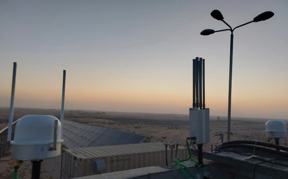
Radar helps generate and maintain tracks across a defined area. Useful for wide-area awareness, low-altitude monitoring, and constant updates on movement, altitude, direction, and speed. In many deployments, radar provides the core track for cueing and verification for other sensors.
Its performance is environment-dependent. Clutter, terrain, target profile, installation geometry, mast height and nearby infrastructure can affect detection and track quality. Radar should be evaluated against the actual site, not only against maximum-range figures.
EO/IR
EO/IR supports visual verification. It helps operators confirm whether a track is a drone, bird, aircraft, or another object. This matters before escalation, dispatch, or any response that requires a higher confidence threshold.
EO/IR is especially useful when cued by another sensor, such as radar or RF. Its limitations include weather, glare, darkness, fog, range, and an obstructed line of sight.
AI-assisted classification
AI-assisted classification can help prioritise alerts, reduce false positives, and support operator attention. It can improve triage, but it can’t replace human authority, legal review or rules of engagement.
Its value is strongest when it helps operators focus first on tracks with the highest confidence, proximity, and operational relevance. Like any structured support workflow, alerts only become useful when they are triaged, prioritised, assigned, and escalated through a clear process. In Counter-UAS operations, that means reducing noise, surfacing the most urgent tracks, and giving teams a clearer path from alert to verification.
Correlation is the value that counts. RF might provide early warning, radar might track, EO/IR might confirm the object and AI-assisted classification might help prioritise the operator’s attention. These inputs are not separate alerts; they are combined to create a single picture of the airspace, making the system more useful.
From alert to verified action
Drone detection and tracking only matter if they feed a repeatable, auditable response workflow. The goal is not simply to show that an object appeared in protected airspace. The goal is to move from uncertainty to verified action fast enough to preserve decision time.
Detect
The system identifies possible drone activity through the appropriate sensor mix. This may include RF detection, radar, EO/IR, acoustic sensing, or other site-specific inputs. At this stage, the system is flagging that an object or signal may require attention.
Track
The system then maintains a stable picture of the drone’s movement, altitude, speed, direction, and proximity to sensitive areas. This is where track continuity becomes operationally important. A stable track helps operators understand whether the drone is approaching a restricted zone, loitering near a critical asset, moving away, or changing behaviour.
Verify
Verification converts a track into decision-ready information. The track is correlated with EO/IR imagery, RF data, location context and observed behaviour by the operator or system workflow. This helps to confirm whether the object is a drone, whether it is unauthorised and whether it meets the threshold for escalation.
Verification reduces false alarms. That keeps teams from sending personnel, interrupting operations or ramping up responses on one unconfirmed alert.
Respond
The organisation then acts in accordance with legal authority, rules of engagement (ROE), and site-specific safety constraints. Depending on the environment, response can range from continued monitoring to dispatching security teams to notifying law enforcement to coordinating with operations teams to initiating temporary shutdown procedures or, where authorised, neutralisation.
A strong counter-UAS workflow should leave operators with a clear incident record: what was detected, how it was tracked, how it was verified, who made the decision, and what action followed. This is also where governance matters. A documented risk management policy can help organisations define who owns a risk, what evidence is required, when escalation is needed, and how response decisions are approved, recorded, and reviewed.
| Evaluation area | What to ask |
| Detection coverage | Which drone profiles, flight paths, altitudes, and site zones must the system detect? |
| Track continuity | Can the system maintain a stable track as the drone changes altitude, speed, direction, or proximity to protected areas? |
| Sensor correlation | Does the platform combine RF, radar, EO/IR, and other inputs into one airspace picture, or does it produce separate alerts? |
| Verification workflow | How quickly can operators confirm whether the object is a drone, a bird, an aircraft, clutter, or benign activity? |
| False alarm control | How does the system reduce nuisance alerts from birds, vehicles, moving vegetation, RF congestion, or site activity? |
| C4I integration | Can detection and tracking data feed existing command, control, VMS, SOC, or dispatch workflows? |
| Operator burden | Does the workflow support fast cueing, prioritisation, logging, and escalation without requiring operators to stitch information together manually? |
| Auditability | Does the system record the timeline, sensor evidence, verification steps, and response actions for review or reporting? |
| Authorised response | Are response options aligned with legal authority, ROE, operational regulations, and site-specific safety constraints? |
How SKYLOCK supports detection and tracking
SKYLOCK is a multi-layer Counter-UAS platform supporting drone detection and tracking, and is designed to take organisations from fragmented alerts to a unified operational picture.
Depending on site, mission and configuration, SKYLOCK can integrate RF detection, radar tracking, EO/IR verification, AI-assisted classification, and open-architecture C4I. The goal is not just to find the drone, but to enable operators to understand what it is and where it is going, whether escalation is required, and what action is authorised.
This provides faster validated identification, improved low-altitude airspace awareness, fewer false alarms, and improved interoperability with current command environments. Operator-light workflows enable teams to prioritise alerts, cue verification, maintain incident timelines, and coordinate responses.
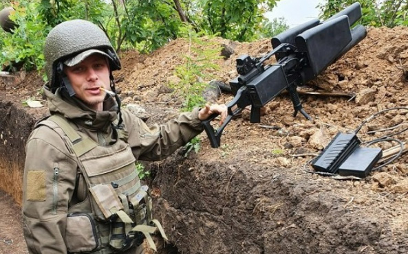
Where permitted, SKYLOCK also supports authorised response options that comply with legal authority, rules of engagement, operational regulations and site-specific safety constraints. This distinction is important because response tools such as anti-drone guns are not standalone counter-UAS systems. They only become operationally useful after detection, tracking, verification, and command authorisation confirm what the target is, where it is, and whether action is permitted.
Build confidence before the response window closes
Drone detection is only the beginning. The operational value comes from maintaining a reliable track, verifying the object, and moving decision-ready information into a response workflow before uncertainty slows the team down.
For security leaders, the key question is not whether a system can generate an alert. It is whether it preserves decision time, limits false alarms, maintains track continuity, and supports action consistent with legal authority, rules of engagement and site-specific safety constraints. Organisations should assess drone detection and tracking systems on how well they help operators understand what is happening, what matters, and what can be done next.
Talk to SKYLOCK defense expert about designing a drone detection and tracking architecture for your site, mission, and regulatory environment.